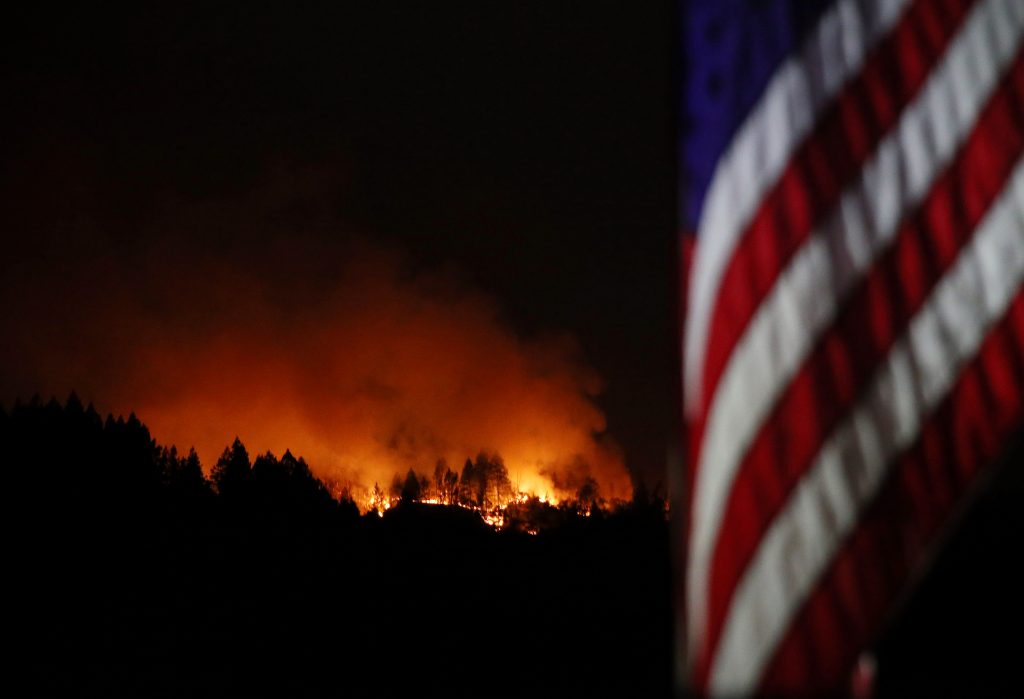
The orange glow in the hills above Calistoga grew increasingly bright Wednesday night as the flames from the Glass Fire crept closer the idyllic downtown in California’s Wine Country.
As of 11 p.m., the fire on the hillside remained “extremely active,” according to the National Weather Service, following a firefight that was entering its fifth day. Throughout Tuesday and Wednesday, favorable weather conditions slowed the spread of the blaze, but another red-flag warning — meaning higher temperatures, lower humidity and northwest winds — was looming Thursday afternoon.
Crews increased their containment of the Glass Fire to 5% by Thursday morning, according to Cal Fire, while the blaze grew by about 5,000 acres overnight to 56,781 acres in total size. At least 143 homes have been destroyed in Napa and Sonoma counties, and at least another 46 sustained damage by the flames.
Early Thursday morning, weather forecasters expanded their weather warning to include the East Bay hills and Santa Cruz mountains, where two large fires were sparked by lightning last month, then fueled by similar hot and dry conditions. The red-flag warning starts at 1 p.m. Thursday and will remain in place through at least 6 p.m. Friday, according to the NWS.


CLICK HERE if you’re having a problem viewing the photos on a mobile device.
In the immediate Bay Area, air quality was expected to take a dive through at least Friday, according to the NWS, as smoke from “numerous” fires drifted toward the region. Forecasters also issued a heat advisory for the region from 11 a.m. to 8 p.m. Thursday with temperatures expected to be 15-25 degrees higher than normal.
On Wednesday, investigators narrowed in on a potential site where the Glass Fire initially ignited, but it could be months before an official cause is known.
In Santa Rosa, many of the evacuation orders were downgraded late Tuesday to warnings, allowing about 22,600 residents to return home. About 13,000 Santa Rosa residents are still under evacuation orders, as is the whole town of Calistoga in the Napa Valley.
On Wednesday night, a new round of evacuation orders was issued for areas between Old Lawley Toll Road and Pope Valley Road from Ink Grade Road to Aetna Springs Road, as well as all recreational areas in or near Robert Louis Stevenson State Park. Highway 29 from Tubbs Lane to the Lake County line remains open to through vehicle traffic.
The fire is largely burning in the brushy hillsides and oak woodlands around Napa Valley, but also is threatening some areas of Sonoma County, including the community of Kenwood. Fire officials expect conditions to deteriorate through Friday night with higher temperatures, lower humidity and gusts up to 30 mph at the highest elevations.
Crews battling the Zogg Fire to the north gained significant containment on the blaze Wednesday. By that evening, Cal Fire reported 26% containment — up from 7% that morning — and about 3,000 new acres burned for a total of 55,046 blackened acres between Shasta and Tehama counties.
With the calendar turned to October, the heart of California’s fire season has arrived. Already, however, double the land that burned all of last year has been scorched in 2020: roughly 4 million acres, or about five times the size of Yosemite National Park.
Check back for updates.
Go to Source
Author: Evan Webeck, Maggie Angst